
WILLMAR, MN—In an era when unmanned aerial systems seem to be the inevitable future for agricultural data collection, one implement dealer has started offering a service of collecting data for customers with a Cessna airplane, flown by an actual pilot.
Haug Implement of Willmar, Minn., offers data gathering and processing service in central Minnesota, and is expanding.
The company captures images at a 2- to 10-inch resolution.
They are Minnesota’s dealer for AgPixel Agricultural Service, a team of remote sensing and geospatial analysis experts based in Johnston, Iowa. Among other things, AgPixel provides “secure private data storage,” on a physical server, not a cloud-based system.
The system offers multiple data formats, including various orthomosaic (geometrically corrected, high-quality stitching) images. They are provided in various forms — synthesized natural color, color-infrared, colorized NDVI (normalized difference vegetation index), among others.
In the beginning
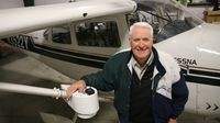
Haug Implement owner Donald “Butch” Haug says technology is nothing new to his company. The family has sold John Deere equipment since 1918 and it is currently managed by Paal Haug, the fourth generation in the family. The dealership has locations in Willmar and Litchfield, Minn.
In 1993, Butch remembers attending a conference in Mankato, Minn., where he realized the precision agriculture age had arrived. Back then, John Deere didn’t offer much in precision agriculture, so in 1995, Haug started marketing Ag Leader yield monitors that had mapping capabilities.
That year, Haug hired Jim Larson as manager of precision farming. Larson was a just-retired U.S. Army colonel, with global positioning system development experience in the military. Larson grew up on a farm in Willmar, Minn., and was interested in the farming applications.
“Nobody knew what to do with precision farming at the time,” Larson recalls.
In those first years, the company didn’t accomplish much except to establish credentials on the cutting edge of technology, Haug says. “If you’re going to sell a new monitor on a combine, you need to be able to teach your customers how to run it.”
Needing proof
An early milestone in John Deere precision farming was Parallel Tracking, which created a “line” on a computer display screen the farm tractor driver could follow through the field.
It’s a predecessor to the auto steer concept that is now commonplace.
Haug Implement could show a return-on-investment — preventing overlapping effort and inputs, saving time and fuel.
To prove precision concepts, the implement dealer hired Neil Graves for custom-farming. Graves used all of the technologies available at the time from John Deere — manual-assisted steering and assisted steering. Graves did the tillage work and planting with those tools.
Haug remembers the day Graves sheared a pin on a marker arm when planting, but was able to keep planting anyway, using just GPS guidance. (“Old Norwegians in the organization require some measure of proof,” Larson jokes.)
Larson and Graves produced a detailed, organized book of data from the custom farming experiment. It provided an example of how customers could organize their data, and has been the example beyond the dealership’s territory.
“Things were getting interesting, but we weren’t yet talking about precision farming,” Haug says. “We were talking about information management.”
In 1996, the company purchased its first mapping software. The idea was to study the farm fields by the foot, not by the acre.
Through it all, the limiting factor with collecting data was that farmers were limited by when they could get into the field for planting, scouting, spraying and harvest. It didn’t provide a necessary series of pictures to show growth patterns during the growing season, or to show insect or moisture pressure.
That’s why farmers need aerial imagery.
Imagery choices
There are three types of aerial imagery — satellite, aircraft and UAVs. Each has its pros and cons.
Satellite imagery is relatively inexpensive, but has a resolution of only 5 to 20 meters. Aircraft pictures have 2- to 4-inch resolution, or 10 inches, when stitched together. Drones have data accurate to 1-inch resolution.
In 2013, Cal Knudsen, then Haug Implement’s assistant integrated solutions manager, told Haug he wanted to learn more about drones as a way to look at farm fields. “I said, ‘Go buy one. Let’s try it, just to see what they are,'” Haug recalls. The fixed-wing drone at the time cost about $15,000, and had a camera.
In 2014, Haug Implement had started working with AgPIxel. The company assists customers using unmanned aerial vehicles and manned aircraft systems in acquiring, processing and analyzing agricultural data. The company touts its quick turnaround of data processing — “often by the next day” — as well as in-house research and development.
Haug Implement acquired some near-infrared images AgPixel software and AgPIxel converted it to the NDVI image.
Among other things, Haug Implement learned drones didn’t fit their company’s business logistics. “For an individual farmer to go out and fly a single field here, a single field there, it might work great,” Haug says. “But for us, as a provider of the imagery, and a processor of the imagery, we need something we can go out and fly tens or hundreds of fields, and thousands of acres within an efficient timeframe.”
The plane truth
In July 2014 the implement company bought a Cessna 182 aircraft. They added and camera, costing another $28,500, as well as some key personnel.
In January 2015, Knudsen, who had become manager of integrated solutions, hired Sam Romain, who was still a student at Ridgewater College in Willmar. Knudsen and Romain worked to coordinate and process information for acres with individual farmers and cooperatives.
The company flew over 10,000 acres last year and registered a total of 40,000 acres in the AgPixel “portal.” The portal includes field boundaries in a “shape file,” with flying instructions for potential flights through the company.
Haug Implement is still working on the fee structure.
In 2015, the standard charge was $3.90 per acre, per flight, although there was a 40-cent-per-acre promotional discount briefly. Future pricing is likely to be in that general, rough parameter, but not yet determined.
In the first year, the company worked within the 15 counties around Willmar, but hope to double the acreage through 2016.
The contract involves a seven-day acquisition window, which means the company has flexibility in flying fields based on weather and other factors. “If it’s raining, we can’t take imagery,” Romain says.
Typically, the company will fly at least 1,000 acres in a flight.
AgPixel can process up to 1 million acres per day with a 24-hour turnaround. Haug Implement guarantees 48 hours, but last year delivered in half the time.
As they grow, the plan is to have more cameras and more aircraft, located as a satellite from Willmar.
They plan to work with more cooperatives and agronomists to market the service.
“To come full circle with imagery, you have to have someone who can get the imagery, process the imagery, and then someone who can read and analyze the imagery back to the farmer so they can implement it,” Romain says. “You need to have someone who really understands the field, the farmer, the operation, what’s trying to be achieved on that farm to plug in that imagery to make it useful.”
Difficult drones
Besides logistics, another reason the company steered away from drones is uncertain government regulation.
The Federal Aviation Administration has evolved some of its rules, but the final rules remain unknown. One of the latest discussions is that all drones might have to be registered. There is speculation that farmers, as commercial entities, might be required to get a so-called “333 exemptions” that involves paperwork and waiting.
“We don’t know what the FAA is going to come up with,” Haug says. “One of the reasons we backed off on the drone side of things is that we don’t want to be out of compliance with any law.”
Haug and Larson say the technology won’t stop.
“I think Haug Implement puts precision agriculture above other things,” Haug says. “Drones is not the big deal. The big deal is the farmer’s decision making that improves his profitability. That’s the hook. That’s the incentive. We’re trying to provide more tools so they can make better decisions. The idea of precision farming — my personal opinion — is that it’s not a product. It’s not GPS, not mapping software: it’s a process, consisting of multiple practices to make decisions.”